Watches, Warnings & Advisories for Sunflower Co.

Thursday, January 31, 2013

January 2013 Precipitation Review

Here is a composite chart showing rainfall for the month of January, 2013.  A total of 10.94 inches of rainfall was recoded in www.cocorahs.org rain gauge MS-SF-1, located on the north side of Indianola, Mississippi.

January was an active month for precipitation, accumulating just under 11" of rainfall.  There were two days of sleet and freezing rain on January 14-15.   Precipitation was recorded on 18 days this month, with the single highest amount on January 10 at 3.23 inches.

If you're willing to record daily precipitation totals, please visit the CoCoRaHS website linked above for more information on how to join the network.  CoCoRaHS data is used by a wide variety of organizations, including the National Weather Service, emergency mangers, hydrologists, and many others.  CoCoRaHS data can be enhanced by having one station per square mile in urban areas, and one station every 36 square miles (survey township size) in rural areas.

DatePrecip
01/01/2013     1.84
01/02/20130.18
01/03/20130.00
01/04/20130.00
01/05/20130.01
01/06/20130.02
01/07/20130.00
01/08/20130.00
01/09/20130.12
01/10/20133.23
01/11/20132.03
01/12/20130.48
01/13/20130.28
01/14/20131.23
01/15/20130.20
01/16/20130.32
01/17/20130.01
01/18/20130.00
01/19/20130.00
01/20/20130.00
01/21/20130.00
01/22/20130.00
01/23/20130.00
01/24/20130.00
01/25/20130.00
01/26/20130.09
01/27/20130.03
01/28/2013T
01/29/20130.00
01/30/20130.87
01/31/2013T
Totals : 10.94

Wednesday, January 30, 2013

Storm Damage Reports from 1/29/13 Storms

Survey teams from the National Weather Service office in Jackson, MS toured several areas today to survey damage and validate radar data from storms that occurred on January 29-30, 2013.  Here are the results of their surveys today.

Local Storm Report by NWS JAN: 3 E Scott [Bolivar Co, MS] NWS storm survey reports TORNADO of EF at 29 Jan, 06:47 PM CST -- NWS storm survey found an EF-0 tornado with maximum winds of 75mph. this tornado touched down briefly near the Stringtown community and uprooted one large tree and caused shingle damage to three homes.

Local Storm Report by NWS JAN: 6 SW Cleveland [Bolivar Co, MS] NWS storm survey reports TORNADO of EF at 29 Jan, 11:10 PM CST -- NWS storm survey found an EF-1 tornado with maximum winds of 100mph and maximum width of 150 yards. touched down around 2.5 WSW of Skene community and ended on Hwy 8 near Cleveland Municipal Airport.

Local Storm Report by NWS JAN: 2 SE Shaw [Sunflower Co, MS] NWS storm survey reports DOWNBURST at 30 Jan, 12:20 AM CST -- several power poles were pushed over or snapped by 80 to 90 mph downburst winds near the community of Frazier on Highway 448.

The following are storm damage reports gathered by NWS Jackson for the same event:

Location: 1 E of Leland, MS [Washington County]
Time: 2013-01-30 01:27 UTC
Event: 0 TSTM WND DMG
Source: emergency mngr
Remark: reports that a roof was blown off at lillos restaurant on highway 82 east.

Location: 2 SW of Cleveland, MS [Bolivar County]
Time: 2013-01-30 05:14 UTC
Event: 0 TSTM WND DMG
Source: emergency mngr
Remark: a 1 mile stretch of power poles were snapped along shaw-skene rd. hail also occurred in this area...size unknown.

Location: Cleveland (Delta State Campus) [Bolivar County]
Time: 2013-01-30 06:10 UTC
Event: 0 TSTM WND DMG
Source: emergency mngr
Remark: tree down on the delta state campus...a few power lines down across the county.

Location: Itta Bena [Leflore County]
Time: 2013-01-30 07:10 UTC
Event: 0 TSTM WND DMG
Source: law enforcement
Remark: a few power lines down.

Location: 5 SSW of Black Hawk [Carroll County]
Time: 2013-01-30 07:40 UTC
Event: 0 TSTM WND DMG
Source: law enforcement
Remark: trees down along Holly Grove and Meeks road off highway 17

Location: Zama [Attala County]
Time: 2013-01-30 09:50 UTC
Event: 0 TSTM WND DMG
Source: law enforcement
Remark: several trees down with a few across hwy 19.


Rainfall Roundup from 1/29/13 storms

A few of our readers have expressed an interest in rainfall totals from significant storm systems that affect our area.

The data below was gathered from stations participating in the Community Collaborative Rain, Hail, & Snow Network (CoCoRaHS), and National Weather Service observation stations at the airports in Greenwood and Greenville.

CoCoRaHS Stations
MS-WS-1, 3.3mi ENE of Leland: 2.28"
MS-BV-1, 0.1mi WSW of Shaw: 1.52"
MS-BV-2, 0.1mi NNW of Duncan: 2.67"
MS-SF-1, 1.1mi NE of Indianola: 0.87"
MS-CR-1, 4.8mi WNW of Vaiden: 1.36"

NWS Observation Station at Greenville (rainfall between 7:00am 1/29 and 7:00am 1/30): 1.68"

NWS Observation Station at Greenwood (rainfall between 7:00am 1/29 and 7:00am 1/30): 0.85"

Meteorologists and hydrologists with the National Weather Service utilize rainfall data to validate radar algorithms, and to provide for more accurate flood forecasts.  Having good, accurate data is critical to their calculations.

The Community Collaborative Rain, Hail, & Snow Network (CoCoRaHS) is comprised of volunteer observers around the nation who, using standardized rain gauges, record and report daily precipitation amounts.  One goal of the CoCoRaHS Network is to have at least one observer per square mile in urban areas/cities, and at least one per thirty six square-mile area in rural areas.  Currently, there are only two CoCoRaHS observers in Bolivar County, two in Washington County, one in Sunflower County, and one in Carroll County.  Let me encourage you to join the CoCoRaHS network.  One of my meteorologist friends at NWS Jackson once told me that the one thing a forecaster will never turn down is more data!

Reading and reporting daily rainfall takes about five minutes of your morning routine.  Visit www.cocorahs.org for more information on the program and how to order your CoCoRaHS rainfall gauge.

Tuesday, January 29, 2013

Severe Weather Tonight 1/29/13

***Edit at 1:15pm - no real changes to the forecast for storms tonight.  Timing remains as indicated below, with the possibility of discreet cells forming ahead of the main squall line.  If these cells develop, they could affect the western Mississippi Delta area as early as 6:00pm.

***Edited at 11:20am to update Hazardous Weather Outlook and Storm Prediction Center graphics***

The information below is drawn from this morning's forecast.  I will post an update after 1:30pm today with the latest information.

To summarize: strong to severe storms are expected to develop and affect the area late this evening through the overnight hours into Wednesday morning.  Areas generally north of Interestate-20 have the highest risk for severe weather, including damaging winds up to 80 miles per hour and strong tornadoes.

HAZARDOUS WEATHER OUTLOOK...UPDATED
NATIONAL WEATHER SERVICE JACKSON MS
1032 AM CST TUE JAN 29 2013

THIS HAZARDOUS WEATHER OUTLOOK IS FOR PORTIONS OF CENTRAL
MISSISSIPPI...NORTHEAST LOUISIANA...AND EXTREME SOUTHEAST ARKANSAS.

.DAY ONE...TODAY AND TONIGHT

WINDY CONDITIONS WILL DEVELOP TODAY AS A STORM SYSTEM TAKES SHAPE
ACROSS THE PLAINS. WINDS WILL INCREASE TO 15 AND 30 MPH ACROSS MUCH
OF THE ARKLAMISS BY MIDDAY WITH GUSTS REACHING 40 TO 45 MPH IN THE
ADVISORY LOCATIONS. RESIDENTS ARE URGED TO SECURE ALL LOOSE OUTDOOR
ITEMS AND BEWARE OF ANY OLDER OR ROTTED TREES THAT COULD BE TOPPLED.

FOR TONIGHT...A SEVERE WEATHER OUTBREAK IS EXPECTED TO DEVELOP AND
BRING WIDESPREAD DAMAGING WINDS TO THE REGION ALONG WITH SOME
TORNADOES. DUE TO A RARE COMBINATION OF INTENSE WIND SHEAR AND
INSTABILITY FOR THIS TIME OF YEAR...SOME HIGHER END SEVERE WEATHER
WILL BE POSSIBLE INCLUDING DAMAGING WINDS TO 80 MPH AND A STRONG
TORNADO. THIS ACTIVITY IS EXPECTED BETWEEN 9PM AND 3AM BEFORE MOVING
EAST.

.DAYS TWO THROUGH SEVEN...WEDNESDAY THROUGH MONDAY

THE PROBABILITY FOR WIDESPREAD HAZARDOUS WEATHER IS LOW.

.SPOTTER CALL TO ACTION STATEMENT...
THE ACTIVATION OF STORM SPOTTERS...HAM RADIO OPERATORS...AND
EMERGENCY MANAGEMENT PERSONNEL IN SUPPORT OF SEVERE WEATHER
OPERATIONS WILL BE NEEDED TONIGHT.

   PUBLIC SEVERE WEATHER OUTLOOK  
   NWS STORM PREDICTION CENTER NORMAN OK
   0409 AM CST TUE JAN 29 2013
   
   ...THE MOST SIGNIFICANT THREAT FOR SEVERE THUNDERSTORMS IS EXPECTED
   OVER PARTS OF THE OZARK REGION AND THE LOWER MISSISSIPPI VALLEY THIS
   EVENING THROUGH TONIGHT...
   
   THE NWS STORM PREDICTION CENTER IN NORMAN OK IS FORECASTING THE
   DEVELOPMENT OF DAMAGING WINDS AND A FEW TORNADOES...SOME
   STRONG...OVER PARTS OF THE OZARK REGION AND THE LOWER MISSISSIPPI
   VALLEY THIS EVENING THROUGH TONIGHT.
   
   THE AREAS MOST LIKELY TO EXPERIENCE THIS ACTIVITY INCLUDE
   
          MUCH OF SOUTHERN...CENTRAL AND EASTERN ARKANSAS
          FAR NORTHERN LOUISIANA
          FAR SOUTHEAST MISSOURI
          NORTHWEST AND WEST CENTRAL MISSISSIPPI
          FAR SOUTHWEST TENNESSEE
          FAR NORTHEAST TEXAS
   
   ELSEWHERE...SEVERE STORMS ARE ALSO POSSIBLE FROM...THE SOUTHERN
   PLAINS AND THE SRN EXTENT OF THE LOWER MISSISSIPPI VALLEY NORTHWARD
   TO THE MIDDLE MISSISSIPPI...TENNESSEE AND LOWER OHIO VALLEYS.
   
   A STRONG STORM SYSTEM TRACKING THROUGH THE SOUTHERN PLAINS TO THE
   MIDDLE MISSISSIPPI VALLEY REGION WILL RESULT IN STRENGTHENING WINDS
   THROUGH THE LOWER AND MIDDLE TROPOSPHERE. A MOIST AIR MASS WILL
   CONTINUE TO SPREAD NORTHWARD TODAY THROUGH TONIGHT AHEAD OF A COLD
   FRONT AND DRY LINE ADVANCING EASTWARD.  ALTHOUGH THE ENVIRONMENT
   SHOULD ONLY BE MARGINALLY UNSTABLE...THE STRENGTH OF THE DEEP LAYER
   WINDS WILL SUPPORT A THREAT FOR DAMAGING WINDS AND TORNADOES. 
   
   THUNDERSTORMS WILL CONTINUE TO DEVELOP AND SPREAD EAST AND NORTHEAST
   THIS MORNING INTO THE AFTERNOON ACROSS OKLAHOMA...PARTS OF NORTH
   TEXAS AND EASTERN KANSAS. DAMAGING WINDS AND TORNADOES WILL BE
   POSSIBLE WITH THIS ACTIVITY INTO THE AFTERNOON.  A MORE SIGNIFICANT
   SEVERE WEATHER THREAT IS EXPECTED TO DEVELOP THIS EVENING THROUGH
   TONIGHT ACROSS MUCH OF ARKANSAS...FAR NORTHEAST TEXAS...NORTHERN
   LOUISIANA...SOUTHEAST MISSOURI INTO WEST CENTRAL AND NORTHWEST
   MISSISSIPPI AND PARTS OF FAR WESTERN TENNESSEE WHERE DAMAGING WINDS
   AND TORNADOES ARE EXPECTED TO BE MORE WIDESPREAD.  THE SEVERE
   WEATHER THREAT WILL SPREAD FARTHER EAST LATER TONIGHT INTO PARTS OF
   THE CENTRAL GULF COAST STATES...TENNESSEE VALLEY AND POTENTIALLY THE
   LOWER OHIO VALLEY...WITH A CONTINUED THREAT FOR DAMAGING WINDS AND A
   FEW TORNADOES.
   
   STATE AND LOCAL EMERGENCY MANAGERS ARE MONITORING THIS DEVELOPING
   SITUATION. THOSE IN THE THREATENED AREA ARE URGED TO REVIEW SEVERE
   WEATHER SAFETY RULES AND TO LISTEN TO RADIO...TELEVISION...AND NOAA
   WEATHER RADIO FOR POSSIBLE WATCHES...WARNINGS...AND STATEMENTS LATER
   TODAY.
 The graphic below depicts the probability of a tornado within 25 miles of a given point.  The hatched area indicates a 10% or greater probability of a strong tornado (EF2-EF5) within 25 miles of a given point.

This graphic depicts the probability of damaging winds of 57 miles per hour or greater within 25 miles of a given point.  The hatched area indicates a 10% or greater probability of damaging winds of 74 miles per hour or greater within 25 miles of a given point.

***DO NOT USE THIS WEBSITE AS YOUR SOLE SOURCE OF WEATHER INFORMATION, ESPECIALLY WATCHES AND WARNINGS. THIS WEBSITE DELIVERS FOCUSED INFORMATION FOR A SPECIFIC GEOGRAPHIC AREA AND IS NOT INTENDED TO PROVIDE TIMELY WEATHER WARNING INFORMATION***

Monday, January 28, 2013

Update on potential storms for Tuesday

As mentioned yesterday, a strong cold front will approach the Mississippi area on Tuesday, bringing the possibility of strong to severe storms Tuesday night into Wednesday morning.  The primary risks associated with these storms are damaging winds up to 80 miles per hour, and strong tornadoes.

During the day Tuesday, counties in the Delta and along the Mississippi River can expect windy conditions, with sustained winds of 20-25 miles per hour and 40 mile per hour gusts.  Areas further east will see sustained 20mph winds with gusts up to 30-35mph.  A Wind Advisory will likely be issued.

As the graphic below illustrates, storms will affect areas west of Interstate 55 in the 8:00pm - 3:00am time frame.  Areas east of I-55 can expect to see storms between 2:00am and 8:00am Wednesday.  However, there is a slight chance that counties along the Mississippi River could see storms develop as early as 6:00-8:00pm Tuesday ahead of the main line of storms.  If they develop, these discrete storms could produce damaging winds and strong tornadoes.

Rainfall of 1/2" to 1" is generally expected across the area, with higher amounts possible in some locations.

HAZARDOUS WEATHER OUTLOOK
NATIONAL WEATHER SERVICE JACKSON MS
508 AM CST MON JAN 28 2013  
THIS HAZARDOUS WEATHER OUTLOOK IS FOR CENTRAL MISSISSIPPI...
NORTHEAST LOUISIANA...AND EXTREME SOUTHEAST ARKANSAS.

.DAY ONE...TODAY AND TONIGHT

THE PROBABILITY FOR WIDESPREAD HAZARDOUS WEATHER IS LOW.

.DAYS TWO THROUGH SEVEN...TUESDAY THROUGH SUNDAY

THE POTENTIAL FOR A SIGNIFICANT SEVERE WEATHER EVENT IS POSSIBLE
TUESDAY NIGHT INTO EARLY WEDNESDAY AS A POTENT STORM SYSTEM BRINGS
TOGETHER A COMBINATION OF INTENSE WIND SHEAR AND INSTABILITY. A
SQUALL LINE OF STORMS LOOKS TO IMPACT THE AREA AND BRING THE RISK FOR
DAMAGING WINDS...SOME AS HIGH AS 80 MPH ALONG WITH TORNADOES...SOME
OF WHICH COULD BE STRONG. LOCALLY HEAVY RAINFALL MAY ALSO OCCUR AS
RICH MOISTURE WILL BE IN PLACE. PLEASE STAY TUNED FOR UPDATES
CONCERNING THIS POTENTIALLY SIGNIFICANT SEVERE WEATHER EVENT.

.SPOTTER CALL TO ACTION STATEMENT...
THE ACTIVATION OF STORM SPOTTERS...HAM RADIO OPERATORS...AND
EMERGENCY MANAGEMENT PERSONNEL IN SUPPORT OF SEVERE WEATHER
OPERATIONS WILL LIKELY BE NEEDED TUESDAY NIGHT AND EARLY WEDNESDAY.
The following graphic illustrates the potential for severe thunderstorms within 25 miles of a given point before 6:00AM Wednesday.  The hatched area indicates a 10% probability of significant severe weather within 25 miles of a given point.

***DO NOT USE THIS WEBSITE AS YOUR SOLE SOURCE OF WEATHER INFORMATION, ESPECIALLY WATCHES AND WARNINGS. THIS WEBSITE DELIVERS FOCUSED INFORMATION FOR A SPECIFIC GEOGRAPHIC AREA AND IS NOT INTENDED TO PROVIDE TIMELY WEATHER WARNING INFORMATION***

Sunday, January 27, 2013

Storms likely Tuesday/Wednesday

Confidence is building for a round of strong to severe weather for the area late Tuesday into Wednesday morning.  As always, we'll keep the most up-to-date information posted as it becomes available.

HAZARDOUS WEATHER OUTLOOK
NATIONAL WEATHER SERVICE JACKSON MS
223 PM CST SUN JAN 27 2013

THIS HAZARDOUS WEATHER OUTLOOK IS FOR CENTRAL MISSISSIPPI...
NORTHEAST LOUISIANA...AND EXTREME SOUTHEAST ARKANSAS.

.DAY ONE...TONIGHT AND MONDAY

THE PROBABILITY FOR WIDESPREAD HAZARDOUS WEATHER IS LOW.

.DAYS TWO THROUGH SEVEN...MONDAY NIGHT THROUGH SATURDAY

A POTENTIALLY SIGNIFICANT SEVERE WEATHER EVENT IS DEVELOPING TUESDAY
NIGHT INTO EARLY WEDNESDAY ACROSS THE REGION. THIS WILL BE POSSIBLE
AS A POTENT STORM SYSTEM BRINGS TOGETHER A COMBINATION OF INTENSE
WIND SHEAR AND INSTABILITY. A SQUALL LINE OF STORMS LOOKS TO IMPACT
THE AREA AND BRING THE RISK FOR DAMAGING WINDS...SOME AS HIGH AS 80
MPH...AND TORNADOES...SOME POSSIBLY STRONG. LOCALLY HEAVY RAINFALL
MAY ALSO OCCUR AS RICH MOISTURE WILL BE IN PLACE. PLEASE STAY TUNED
FOR UPDATES CONCERNING THIS POTENTIALLY SIGNIFICANT SEVERE WEATHER
EVENT.

.SPOTTER CALL TO ACTION STATEMENT...
THE ACTIVATION OF STORM SPOTTERS...HAM RADIO OPERATORS...AND
EMERGENCY MANAGEMENT PERSONNEL IN SUPPORT OF SEVERE WEATHER
OPERATIONS WILL LIKELY BE NEEDED TUESDAY NIGHT AND WEDNESDAY.
 

***DO NOT USE THIS WEBSITE AS YOUR SOLE SOURCE OF WEATHER INFORMATION, ESPECIALLY WATCHES AND WARNINGS. THIS WEBSITE DELIVERS FOCUSED INFORMATION FOR A SPECIFIC GEOGRAPHIC AREA AND IS NOT INTENDED TO PROVIDE TIMELY WEATHER WARNING INFORMATION***

Saturday, January 26, 2013

Weekly Rainfall 1/20/13 - 1/26/13

The data below was compiled using a www.cocorahs.org rain gauge on the north side of Indianola, MS over the past week.  The gauge is read and emptied at approximately 7:00am daily, therefore the rainfall total shown each day is from the prior 24 hours starting at 7:00am.

Total rainfall for the week was 0.09".

Current total January rainfall: 10.04"

Total rainfall for previous month: 6.91"

Date TimeStation NumberStation NameTotal Precip in.New Snow in.Total Snow in.StateCountyView
1/26/2013  7:00 AM  MS-SF-1  Indianola 1.1 N  0.09 NA NA MSSunflower  View
1/25/2013  7:00 AM  MS-SF-1  Indianola 1.1 N  0.00 0.0 NA MSSunflower  View
1/24/2013  7:00 AM  MS-SF-1  Indianola 1.1 N  0.00 0.0 NA MSSunflower  View
1/23/2013  7:00 AM  MS-SF-1  Indianola 1.1 N  0.00 0.0 NA MSSunflower  View
1/22/2013  7:00 AM  MS-SF-1  Indianola 1.1 N  0.00 0.0 NA MSSunflower  View
1/21/2013  7:00 AM  MS-SF-1  Indianola 1.1 N  0.00 0.0 NA MSSunflower  View
1/20/2013  7:00 AM  MS-SF-1  Indianola 1.1 N  0.00 0.0 NA MSSunflower  View

Saturday, January 19, 2013

Weekly Rainfall 1/13/13 - 1/19/13

The data below was compiled using a www.cocorahs.org rain gauge on the north side of Indianola, MS over the past week.  The gauge is read and emptied at approximately 7:00am daily, therefore the rainfall total shown each day is from the prior 24 hours starting at 7:00am.

Total rainfall for the week was 2.04".

Current total January rainfall: 9.95"

Total rainfall for previous month: 6.91"

***NOTE: While snowfall was reported in the area Wednesday night into Thursday, none was present at the time the gauge was recorded, therefore no snowfall was recorded.  Sleet and freezing rain that fell on Monday and Tuesday were melted down and measured as rainfall.
Date TimeStation NumberStation NameTotal Precip in.New Snow in.Total Snow in.StateCountyView
1/19/2013  7:00 AM  MS-SF-1  Indianola 1.1 N 0.00 0.0 NA MSSunflower View
1/18/2013  7:00 AM  MS-SF-1  Indianola 1.1 N 0.00 0.0 NA MSSunflower View
1/17/2013  7:00 AM  MS-SF-1  Indianola 1.1 N 0.01 NA NA MSSunflower View
1/16/2013  7:00 AM  MS-SF-1  Indianola 1.1 N 0.32 NA NA MSSunflower View
1/15/2013  7:00 AM  MS-SF-1  Indianola 1.1 N 0.20 NA NA MSSunflower View
1/14/2013  7:00 AM  MS-SF-1  Indianola 1.1 N 1.23 NA NA MSSunflower View
1/13/2013  7:00 AM  MS-SF-1  Indianola 1.1 N 0.28 NA NA MSSunflower View

Thursday, January 17, 2013

Why This Blog Exists

Two years ago, this blog started out with a simple post:
Welcome to what will be an attempt to collect a wealth of weather information and data from multiple sources, and present it to you in a single, simple-to-read format.  We'll offer some insight into how we interpret National Weather Service forecasts, discussions and other information.  You are asked, and strongly encouraged, to research multiple points of information for weather, and not to rely completely on this blog.

This blog is a private venture, and not directly associated with any local, state, or national governmental agency.  We make no assertions to the timeliness, accuracy, or validity of the data, and the opinions offered here are for informational purposes only.
As we've gone through this very busy weather week with floods, ice storms and snow storms, it occurred to me that I should give you a little more of the background on "why".

You've likely read entries here that, from time to time, discuss the hobby and service that is known as Amateur Radio.  It was my intention to have this blog be a balance of both amateur radio information and weather information.  However, but without any regrets, this website has served the latter function far more than the former.

I mentioned that amateur radio is both a hobby and a service.  As a hobby, we're allowed to experiment with equipment and operating modes, unlike other radio services that are tightly regulated.  In return for that flexibility, amateur radio operators are expected to provide a "public service" of offering to relay messages through the airwaves at no charge for the public.  Specifically, the Code of Federal Regulations says:
Subpart A—General Provisions
§ 97.1 Basis and purpose.
The rules and regulations in this part are designed to provide an amateur radio service having a fundamental purpose as expressed in the following principles:

(a) Recognition and enhancement of the value of the amateur service to the public as a voluntary noncommercial communication service, particularly with respect to providing emergency communications. <emphasis added>
While most of the weather that affects our area rarely results in an emergency situation for most, that potential certainly exists with every thunderstorm or winter weather event.  Amateur radio offers itself to the community as a way to communicate both official and personal messages out of a disaster area.

But this amateur operator thinks we can offer more than just a conduit of communications.  Being aware of potential hazards before they occur is a foundation of preparedness.  Sharing our insights and tidbits of information about upcoming weather seems to be a natural extension of that "value of the amateur service to the public..."

So to define the title "Why This Blog Exists" - it exists as a service to you, the faithful reader.  Amateur radio's partnership with the National Weather Service provides a direct link to the forecasters and some of the data they use.  To not share that with you would be a disservice to the community, and would fall short of one of the noble goals of an amateur radio operator: to communicate.  I hope the information shared here is of value and use to you.  I'm humbled by the number of "hits" that register when weather information is posted.  Thank you!

If Amateur Radio is something that might interest you, please visit the American Radio Relay League, or the Mississippi Section of the ARRL for more information on how to become a licensed operator.

Wednesday, January 16, 2013

Winter Storm Warning & Winter Advisory

Continuing from an earlier post, a WINTER STORM WARNING is in effect for a large portion of Central Mississippi, generally along and east of a line from Vicksburg to Grenada.  a WINTER WEATHER ADVISORY is in effect for counties surrounding the warned area.

Snowfall accumulations of 2 to 4 inches are possible in some areas of the WINTER STORM WARNING.  Snowfall accumulations of 1 to 2 inches are possible in some areas of the WINTER WEATHER ADVISORY.

The primary risk in both areas is ice/slush accumulation on bridges and overpasses causing dangerous travel conditions Thursday morning.

URGENT - WINTER WEATHER MESSAGE
NATIONAL WEATHER SERVICE JACKSON MS
850 PM CST WED JAN 16 2013

...WINTER STORM WITH HEAVY SNOW WILL IMPACT PORTIONS OF THE
ARKLAMISS REGION LATE TONIGHT INTO THURSDAY MORNING...

LEFLORE-GRENADA-CARROLL-MONTGOMERY-WEBSTER-CLAY-LOWNDES-CHOCTAW-
OKTIBBEHA-HUMPHREYS-HOLMES-ATTALA-WINSTON-NOXUBEE-ISSAQUENA-
SHARKEY-YAZOO-MADISON MS-LEAKE-NESHOBA-KEMPER-WARREN-HINDS-RANKIN-
SCOTT-NEWTON-LAUDERDALE-CLAIBORNE-COPIAH-SIMPSON-SMITH-JASPER-
CLARKE-

...WINTER STORM WARNING REMAINS IN EFFECT FROM MIDNIGHT TONIGHT
TO 9 AM CST THURSDAY...

A WINTER STORM WARNING REMAINS IN EFFECT FROM MIDNIGHT TONIGHT TO
9 AM CST THURSDAY.

* TIMING: SNOW WILL DEVELOP TONIGHT AND CONTINUE INTO THURSDAY
  MORNING. PERIODS OF HEAVY SNOW WILL BE LIKELY...WITH THE
  HEAVIEST SNOW FALLING BETWEEN 3 AM AND 8 AM CST.

* MAIN IMPACT: SNOW ACCUMULATIONS OF 2 TO 4 INCHES ARE EXPECTED.
  THE HIGHEST SNOWFALL ACCUMULATIONS ARE EXPECTED ACROSS CENTRAL
  MISSISSIPPI INCLUDING THE JACKSON METROPOLITAN AREA.

* OTHER IMPACTS: DANGEROUS TRAVEL CONDITIONS WILL DEVELOP LATE
  TONIGHT AND CONTINUE INTO THURSDAY MORNING. BRIDGES AND
  OVERPASSES WILL BE MOST SUSCEPTIBLE TO BECOMING SNOW AND SLUSH
  COVERED. THIS WINTER STORM WILL HIGHLY IMPACT THE MORNING
  COMMUTE IN THE THE JACKSON METRO AREA.

PRECAUTIONARY/PREPAREDNESS ACTIONS...

A WINTER STORM WARNING FOR HEAVY SNOW MEANS SEVERE WINTER WEATHER
CONDITIONS ARE EXPECTED OR OCCURRING. SIGNIFICANT AMOUNTS OF SNOW
ARE FORECAST THAT WILL MAKE TRAVEL DANGEROUS. ONLY TRAVEL IN AN
EMERGENCY. IF YOU MUST TRAVEL...KEEP AN EXTRA FLASHLIGHT...
FOOD...AND WATER IN YOUR VEHICLE IN CASE OF AN EMERGENCY.
 
*********************************
URGENT - WINTER WEATHER MESSAGE
NATIONAL WEATHER SERVICE JACKSON MS
850 PM CST WED JAN 16 2013

...WINTER STORM WITH HEAVY SNOW WILL IMPACT PORTIONS OF THE
ARKLAMISS REGION LATE TONIGHT INTO THURSDAY MORNING...

WEST CARROLL-EAST CARROLL-MADISON LA-TENSAS-SUNFLOWER-WASHINGTON-
JEFFERSON-FRANKLIN MS-LINCOLN-LAWRENCE-JEFFERSON DAVIS-COVINGTON-
JONES-

...WINTER WEATHER ADVISORY REMAINS IN EFFECT FROM MIDNIGHT
TONIGHT TO 9 AM CST THURSDAY...

A WINTER WEATHER ADVISORY REMAINS IN EFFECT FROM MIDNIGHT TONIGHT
TO 9 AM CST THURSDAY.

* TIMING: SNOW WILL DEVELOP TONIGHT AND CONTINUE INTO THURSDAY
  MORNING.

* MAIN IMPACT: SNOW ACCUMULATION OF 1 TO LOCALLY 2 INCHES IS
  EXPECTED.

* OTHER IMPACTS: HAZARDOUS TRAVEL CONDITIONS MAY DEVELOP LATE
  TONIGHT AND CONTINUE INTO THURSDAY MORNING...AS SLUSHY
  CONDITIONS DEVELOP ON AREA ROADWAYS. BRIDGES AND OVERPASSES
  WILL BE MOST SUSCEPTIBLE TO ACCUMULATIONS OF ICE AND SNOW.

PRECAUTIONARY/PREPAREDNESS ACTIONS...

A WINTER WEATHER ADVISORY FOR SNOW MEANS THAT PERIODS OF SNOW
WILL CAUSE PRIMARILY TRAVEL DIFFICULTIES. BE PREPARED FOR SNOW
COVERED ROADS AND LIMITED VISIBILITIES...AND USE CAUTION WHILE
DRIVING. 

***DO NOT USE THIS WEBSITE AS YOUR SOLE SOURCE OF WEATHER INFORMATION, ESPECIALLY WATCHES AND WARNINGS. THIS WEBSITE DELIVERS FOCUSED INFORMATION FOR A SPECIFIC GEOGRAPHIC AREA AND IS NOT INTENDED TO PROVIDE TIMELY WEATHER WARNING INFORMATION***

Sunflower River Update 1/16/2013

Now that the bulk of rain has move out of our area, forecasters have revised the flood expectations for the Sunflower River at Sunflower, MS.

The current forecast crest is 25.7 feet on 1/17/2013, with a slow fall to around 22 feet on 1/21/2012.

Here's the latest graph, followed by a text version of forecast stages, times, and dates.

Forecast Data:
|Date(UTC)|  |Stage|  |--Flow-|
01/17 00:00  25.6ft  6.78kcfs
01/17 06:00  25.6ft  6.78kcfs
01/17 12:00  25.6ft  6.78kcfs
01/17 18:00  25.7ft  6.82kcfs
01/18 00:00  25.7ft  6.82kcfs
01/18 06:00  25.7ft  6.82kcfs
01/18 12:00  25.6ft  6.78kcfs
01/18 18:00  25.5ft  6.74kcfs
01/19 00:00  25.4ft  6.7kcfs
01/19 06:00  25.3ft  6.66kcfs
01/19 12:00  25.1ft  6.59kcfs
01/19 18:00  24.8ft  6.48kcfs
01/20 00:00  24.5ft  6.38kcfs
01/20 06:00  24.1ft  6.24kcfs
01/20 12:00  23.8ft  6.14kcfs
01/20 18:00  23.4ft  5.99kcfs
01/21 00:00  23ft  5.85kcfs
01/21 06:00  22.6ft  5.71kcfs
01/21 12:00  22.1ft  5.54kcfs


***DO NOT USE THIS WEBSITE AS YOUR SOLE SOURCE OF WEATHER INFORMATION, ESPECIALLY WATCHES AND WARNINGS. THIS WEBSITE DELIVERS FOCUSED INFORMATION FOR A SPECIFIC GEOGRAPHIC AREA AND IS NOT INTENDED TO PROVIDE TIMELY WEATHER WARNING INFORMATION***

Winter Storm Watch for Central MS

A Winter Storm Watch has been posted for most of Central Mississippi through 9:00am Thursday, January 17, 2013, generally east of a line from Vicksburg to Grenada.  Interstate 20 is roughly the southern border of this watch, and Mississippi Highway 8 as the northern border.  Counties included are: Attala, Carroll, Choctaw, Clay, Grenada, Hinds, Holmes, Humphreys, Issaquena, Kemper, Lauderdale, Leake, Leflore, Lowndes, Madison, Montgomery, Neshoba, Newton, Noxubee, Oktibbeha, Rankin, Scott, Sharkey, Warren, Webster, Winston, Yazoo.

Heavy snow with accumulations of  2 to 4 inches are possible in the counties included in the watch.  Forecasters caution that this watch could be upgraded to a Heavy Snow Warning or a combination of a snow advisory for some areas later this evening.

For counties outside of the watch area, accumulations of up to one inch may occur.

Driving conditions should remain stable, but some areas including the Delta could see patchy ice formation on the roads due to longer exposure to temperatures at or near freezing.  Monitor road conditions carefully, and drive with caution.  

URGENT - WINTER WEATHER MESSAGE
NATIONAL WEATHER SERVICE JACKSON MS
110 PM CST WED JAN 16 2013

...WINTER STORM WATCH IN EFFECT FROM MIDNIGHT CST TONIGHT THROUGH
THURSDAY MORNING...

THE NATIONAL WEATHER SERVICE IN JACKSON HAS ISSUED A WINTER STORM
WATCH...WHICH IS IN EFFECT FROM MIDNIGHT TONIGHT THROUGH THURSDAY
MORNING.

* TIMING: SNOW IS EXPECTED TO BEGIN FALLING OVER THE WATCH AREA AFTER
  MIDNIGHT TONIGHT AND PERSIST INTO AT LEAST MID MORNING THURSDAY.

* MAIN IMPACT: SNOW ACCUMULATION OF 2 TO 4 INCHES IS EXPECTED.

* OTHER IMPACTS: SNOW ACCUMULATION IS EXPECTED PRIMARILY ON GRASSY
  AND ELEVATED SURFACES. WHILE WIDESPREAD TRAVEL PROBLEMS ARE NOT
  CURRENTLY EXPECTED DUE TO ALREADY WET ROADS...IN LOCATIONS THAT
  EXPERIENCE HIGHER SNOWFALL RATES...A SLUSH COULD DEVELOP ON LOCAL
  BRIDGES AND OVERPASSES WHICH COULD MAKE DRIVING ACROSS THEM
  TREACHEROUS.

PRECAUTIONARY/PREPAREDNESS ACTIONS...

A WINTER STORM WATCH MEANS THERE IS A POTENTIAL FOR SIGNIFICANT
SNOW...SLEET...OR ICE ACCUMULATIONS THAT MAY IMPACT TRAVEL.
PLEASE CONTINUE TO MONITOR THE LATEST FORECASTS.


***DO NOT USE THIS WEBSITE AS YOUR SOLE SOURCE OF WEATHER INFORMATION, ESPECIALLY WATCHES AND WARNINGS. THIS WEBSITE DELIVERS FOCUSED INFORMATION FOR A SPECIFIC GEOGRAPHIC AREA AND IS NOT INTENDED TO PROVIDE TIMELY WEATHER WARNING INFORMATION***

Freezing Rain Adivsory in Delta for AM

HAZARDOUS WEATHER OUTLOOK
NATIONAL WEATHER SERVICE JACKSON MS
547 AM CST WED JAN 16 2013

ARZ074-075-LAZ007>009-015-MSZ018-019-025-034-035-040-041-171200-
ASHLEY-CHICOT-MOREHOUSE-WEST CARROLL-EAST CARROLL-RICHLAND-
BOLIVAR-SUNFLOWER-LEFLORE-WASHINGTON-HUMPHREYS-ISSAQUENA-SHARKEY-
547 AM CST WED JAN 16 2013

THIS HAZARDOUS WEATHER OUTLOOK IS FOR CENTRAL MISSISSIPPI...
NORTHEAST LOUISIANA...AND EXTREME SOUTHEAST ARKANSAS.

.DAY ONE...TODAY AND TONIGHT

PERIODS OF LIGHT FREEZING RAIN OR FREEZING DRIZZLE WILL OCCUR TODAY
WITH ADDITIONAL ACCUMULATIONS OF LESS THAN ONE TENTH OF AN INCH.
PRECIPITATION WILL GRADUALLY DECREASE THIS AFTERNOON. A FREEZING
RAIN ADVISORY IS IN EFFECT UNTIL NOON.

ISOLATED LIGHT SNOW SHOWERS WILL BE POSSIBLE THIS EVENING. LITTLE OR
NO SNOW ACCUMULATION IS EXPECTED.

AN UPPER LOW THAT WILL TRACK ACROSS THE AREA TONIGHT WILL PRODUCE
COLDER CONDITIONS ALOFT AND BRING A CHANCE OF SNOW TO THE REGION.
THE AIR MASS WILL DRY IN THE WAKE OF THIS SYSTEM THURSDAY.

.DAYS TWO THROUGH SEVEN...THURSDAY THROUGH TUESDAY

THE PROBABILITY FOR WIDESPREAD HAZARDOUS WEATHER IS LOW.

.SPOTTER CALL TO ACTION STATEMENT...
THE ACTIVATION OF STORM SPOTTERS...HAM RADIO OPERATORS...AND
EMERGENCY MANAGEMENT PERSONNEL IN SUPPORT OF SEVERE WEATHER
OPERATIONS IS NOT EXPECTED THROUGH NEXT TUESDAY.
 

***DO NOT USE THIS WEBSITE AS YOUR SOLE SOURCE OF WEATHER INFORMATION, ESPECIALLY WATCHES AND WARNINGS. THIS WEBSITE DELIVERS FOCUSED INFORMATION FOR A SPECIFIC GEOGRAPHIC AREA AND IS NOT INTENDED TO PROVIDE TIMELY WEATHER WARNING INFORMATION***

Tuesday, January 15, 2013

Winter Weather, Sunflower River Update

The ICE STORM WARNING has been extended until 6:00am Wednesday morning for a number of counties in Northwest Mississippi, including Bolivar, Washington, Sunflower, Humpheys, Leflore, Holmes, and Carroll.
 
We will continue to see periods of rain overnight tonight through Wednesday, with a slight chance for a rain/snow mix late Wednesday into early Thursday. 

The weekend promises more dry conditions, with temperatures in the 50s for highs.  But early next week could see a return of Arctic temperatures with lows in the 20's or upper teens.

Finally, the Sunflower River at Sunflower continues to rise, with a new forecast crest of 26.5" at 6:00am Thursday morning.  Remember, this is only a forecast stage and time, and is likely to change somewhat.  You'll find more information and a graph near the bottom of this entry.  For comparison, the record stage for the Sunflower was 28.37 in 1973, and the most recent high was 27.6 in December of 2001.

First, the current Hazardous Weather Outlook and ice storm graphics:

HAZARDOUS WEATHER OUTLOOK
NATIONAL WEATHER SERVICE JACKSON MS
347 PM CST TUE JAN 15 2013

THIS HAZARDOUS WEATHER OUTLOOK IS FOR PORTIONS OF CENTRAL
MISSISSIPPI...NORTHEAST LOUISIANA...AND EXTREME SOUTHEAST ARKANSAS..

.DAY ONE...TONIGHT AND WEDNESDAY

PERIODS OF FREEZING RAIN WILL CONTINUE ACROSS THE AREA THIS AFTERNOON
INTO WEDNESDAY MORNING. ADDITIONAL ICE ACCUMULATIONS OF ONE QUARTER
TO ONE HALF INCH ARE EXPECTED WITH LOCALLY HIGHER AMOUNTS POSSIBLE THIS
AFTERNOON AND EVENING. AN ICE STORM WARNING REMAINS IN EFFECT
THROUGH 6 AM WEDNESDAY WITH ANOTHER ONE TENTH TO ONE QUARTER INCH OF
ICE POSSIBLE OVERNIGHT.

.DAYS TWO THROUGH SEVEN...WEDNESDAY NIGHT THROUGH MONDAY

THE PROBABILITY FOR WIDESPREAD HAZARDOUS WEATHER IS LOW.

.SPOTTER CALL TO ACTION STATEMENT...
THE ACTIVATION OF STORM SPOTTERS...HAM RADIO OPERATORS...AND
EMERGENCY MANAGEMENT PERSONNEL IN SUPPORT OF SEVERE WEATHER
OPERATIONS IS LIKELY THIS EVENING AND TONIGHT.
 
For the Sunflower River at Sunflower, MS

***DO NOT USE THIS WEBSITE AS YOUR SOLE SOURCE OF WEATHER INFORMATION, ESPECIALLY WATCHES AND WARNINGS. THIS WEBSITE DELIVERS FOCUSED INFORMATION FOR A SPECIFIC GEOGRAPHIC AREA AND IS NOT INTENDED TO PROVIDE TIMELY WEATHER WARNING INFORMATION***

Hazardous Weather Outlook 15 JAN 13

HAZARDOUS WEATHER OUTLOOK
NATIONAL WEATHER SERVICE JACKSON MS
544 AM CST TUE JAN 15 2013

THIS HAZARDOUS WEATHER OUTLOOK IS FOR CENTRAL MISSISSIPPI...
NORTHEAST LOUISIANA...AND EXTREME SOUTHEAST ARKANSAS.

.DAY ONE...TODAY AND TONIGHT

PERIODS OF FREEZING RAIN WILL REDEVELOP ACROSS THE AREA TODAY.
ADDITIONAL ICE ACCUMULATIONS OF ONE QUARTER TO ONE HALF INCH ARE
EXPECTED WITH LOCALLY HIGHER AMOUNTS POSSIBLE. AN ICE STORM WARNING
REMAINS IN EFFECT THROUGH 6 PM TODAY. PERIODS OF FREEZING RAIN WILL
CONTINUE TONIGHT AND THE ICE STORM WARNING MAY BE EXTENDED INTO THE
OVERNIGHT HOURS. ANOTHER ONE TENTH TO ONE QUARTER INCH OF ICE MAY BE
POSSIBLE.

.DAYS TWO THROUGH SEVEN...WEDNESDAY THROUGH MONDAY

AN UPPER LOW EXPECTED TO PASS THROUGH THE REGION WEDNESDAY NIGHT
THROUGH EARLY THURSDAY WILL BRING A CHANCE OF RAIN...POSSIBLY MIXING
WITH OR CHANGING OVER TO SNOW...ESPECIALLY EAST OF INTERSTATE
FIFTY-FIVE. THERE IS STILL UNCERTAINTY WITH THIS SYSTEM SO STAY
TUNED FOR FUTURE UPDATES. AT THIS TIME A SIGNIFICANT IMPACT IS NOT
ANTICIPATED SINCE GROUND TEMPERATURES WILL LIKELY BE AT LEAST A
LITTLE ABOVE FREEZING.

.SPOTTER CALL TO ACTION STATEMENT...
THE ACTIVATION OF STORM SPOTTERS...HAM RADIO OPERATORS...AND
EMERGENCY MANAGEMENT PERSONNEL IN SUPPORT OF SEVERE WEATHER
OPERATIONS IS LIKELY TODAY.


***DO NOT USE THIS WEBSITE AS YOUR SOLE SOURCE OF WEATHER INFORMATION, ESPECIALLY WATCHES AND WARNINGS. THIS WEBSITE DELIVERS FOCUSED INFORMATION FOR A SPECIFIC GEOGRAPHIC AREA AND IS NOT INTENDED TO PROVIDE TIMELY WEATHER WARNING INFORMATION***

Monday, January 14, 2013

Winter Weather Update

ICE STORM WARNING continues until 6:00pm Tuesday for Bolivar, Sunflower, Washington, Leflore, Grenada, Carroll, Montgomery, Holmes, Humphreys, Sharkey, Issaquena, Webster, and Yazoo counties.

We're experiencing a respite in the rainfall, but expect it to return overnight tonight and continue through tomorrow.  With temperatures hovering at or near freezing, chances remain for freezing rain to resume before morning.  An additional 0.20 to 0.5 inch accumulation are possible in the warning area.

Road conditions in some areas today were dangerous with icing reported on bridges across the Delta.  Power outages were reported in a number of areas.  Over 9" of rainfall have been recorded in Indianola thus far in January.  Trees laden with ice are susceptible to toppling in these saturated grounds.  Rain is expected to continue through Wednesday night into Thursday.

For Wednesday night and early Thursday morning, an upper level low will pass over the area, raising the rainfall chances.  There is a slight chance of snow or a rain/snow mix for the same period.  Uncertainty exists with this system, and updates will be provided as we get closer to that time frame.

Below are two weather statements, the current Hazardous Weather Outlook and the Ice Storm Warning Statement.  Two graphics follow.
 
HAZARDOUS WEATHER OUTLOOK
NATIONAL WEATHER SERVICE JACKSON MS
805 PM CST MON JAN 14 2013

THIS HAZARDOUS WEATHER OUTLOOK IS FOR EXTREME SOUTHEASTERN ARKANSAS
AND PORTIONS OF CENTRAL MISSISSIPPI AND NORTHEASTERN LOUISIANA.

.DAY ONE...TONIGHT AND TUESDAY

AN ICE STORM WARNING IS IN EFFECT UNTIL 6PM TUESDAY. FREEZING RAIN
WILL REDEVELOP OVERNIGHT AND CONTINUE THROUGH TUESDAY RESULTING IN
ADDITIONAL DANGEROUS ICE ACCUMULATIONS...PLEASE REFER TO THE ICE
STORM WARNING FOR MORE DETAILS.

.DAYS TWO THROUGH SEVEN...TUESDAY NIGHT THROUGH SUNDAY

THE PROBABILITY FOR WIDESPREAD HAZARDOUS WEATHER IS LOW.

.SPOTTER CALL TO ACTION STATEMENT...
THE ACTIVATION OF STORM SPOTTERS...HAM RADIO OPERATORS...AND
EMERGENCY MANAGEMENT PERSONNEL IN SUPPORT OF SEVERE WEATHER
OPERATIONS WILL BE NEEDED THROUGH TOMORROW.
************************************************* 
URGENT - WINTER WEATHER MESSAGE
NATIONAL WEATHER SERVICE JACKSON MS
723 PM CST MON JAN 14 2013

...ICE STORM WARNING REMAINS IN EFFECT UNTIL 6 PM CST TUESDAY...

AN ICE STORM WARNING REMAINS IN EFFECT UNTIL 6 PM CST TUESDAY.

* TIMING: FREEZING RAIN WILL REDEVELOP OVERNIGHT...PARTICULARLY AFTER
  MIDNIGHT AS ANOTHER UPPER LEVEL DISTURBANCE APPROACHES.

* MAIN IMPACT: ICE ACCUMULATION OF A QUARTER TO HALF INCH OCCURRED
  OVER MUCH OF THE WARNING AREA EARLIER TODAY. ADDITIONAL ICE
  ACCUMULATION OF 0.25 TO 0.5 INCH WILL BE POSSIBLE LATER TONIGHT
  INTO TUESDAY.

* OTHER IMPACTS: SUCH ICING WILL CAUSE DANGEROUS TRAVEL
  CONDITIONS ON ELEVATED SURFACES...PARTICULARLY ON BRIDGES AND
  OVERPASSES. ADDITIONALLY...ACCUMULATING ICE ON TREES AND POWER
  LINES MAY CAUSE THEM TO FAIL...RESULTING IN DOWNED LINES AND
  SUBSEQUENT POWER OUTAGES.

PRECAUTIONARY/PREPAREDNESS ACTIONS...

AN ICE STORM WARNING MEANS SEVERE WINTER WEATHER CONDITIONS ARE
EXPECTED OR OCCURRING. SIGNIFICANT AMOUNTS OF ICE ACCUMULATIONS
WILL MAKE TRAVEL DANGEROUS OR IMPOSSIBLE. IF YOU MUST TRAVEL...
KEEP AN EXTRA FLASHLIGHT...FOOD...AND WATER IN YOUR VEHICLE IN
CASE OF AN EMERGENCY. ICE ACCUMULATIONS AND WINDS WILL LIKELY
LEAD TO SNAPPED POWER LINES AND FALLING TREE BRANCHES THAT ADD TO
THE DANGER. 


***DO NOT USE THIS WEBSITE AS YOUR SOLE SOURCE OF WEATHER INFORMATION, ESPECIALLY WATCHES AND WARNINGS. THIS WEBSITE DELIVERS FOCUSED INFORMATION FOR A SPECIFIC GEOGRAPHIC AREA AND IS NOT INTENDED TO PROVIDE TIMELY WEATHER WARNING INFORMATION***

Pictures from Today

Here's a few pictures I grabbed of the sleet and freezing rain event we had today.  More is expected overnight and tomorrow, so don't get too relaxed just yet!

Between 10:10am and 10:15am today we had a brief period of sleet, with thunder, which means there was a good bit of convection in the storm.  Here's a look at the sleet diameter, ranging from 1/16th-inch up to 3/16th-inch in diameter.  The very first sleet that fell was slightly larger than this.


Next is view of ice accumulation on a river birch tree in the yard.  To measure accumulation, you should measure the radial accumulation, not the complete diameter of the ice.  Here it's about 1/16th of an inch.

Finally, this is my CoCoRaHS rain gauge after being exposed to the elements all day.  For something that will hold eleven inches of rain, this would be one mega-sized frosty mug!

MEMA Weather Press Release

FOR IMMEDIATE RELEASE                                                                                                                                                               Jan. 14, 2013

MORE ICE AND WINTER PRECIPITATION EXPECTED IN PARTS OF MISSISSIPPI

PEARL – The Mississippi Emergency Management Agency is monitoring a weather system moving through the state bringing ice and freezing rain to much of the northern half of the state, and rain to the southern portion of 
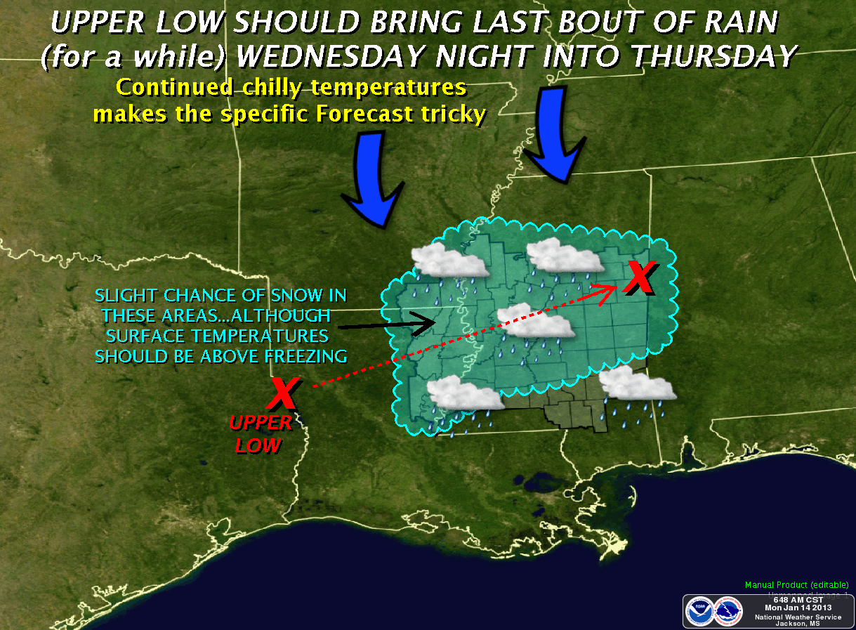
the state. The latest National Weather Service forecast calls for a break in the weather this evening, with another system moving in early tomorrow morning.

NWS has issued the following advisories, watches and warnings which are subject to change due to developing weather conditions:
·         Winter Storm Watch: Alcorn, Benton, Calhoun, Chickasaw, Itawamba, Lafayette, Lee, Marshall, Monroe, Panola, Pontotoc, Prentiss, Quitman, Tallahatchie, Tippah, Tishomingo, Union and Yalobusha counties.
·         Freezing Rain Advisory: Attala, Choctaw, Clay, Hinds, Leake, Lowndes, Madison, Oktibbeha, Rankin, Warren, and Winston counties.
·         Winter Weather Advisory: Alcorn, Benton, Calhoun, Chickasaw, Coahoma, DeSoto, Itawamba, Lafayette, Lee, Marshall, Monroe, Panola, Pontotoc, Prentiss, Quitman, Tallahatchie, Tate, Tippah, Tishomingo, Tunica, Union and Yalobusha.
·         Ice Storm Warning: Bolivar, Carroll, Grenada, Holmes, Humphreys, Issaquena, Leflore, Montgomery, Sharkey, Sunflower, Washington, Webster and Yazoo counties.
·         Flood Warning: Attala, Carroll, Clarke, Clay, George, Greene, Hancock, Hinds, Holmes, Jackson, Jones, Lawrence, Leflore, Lowndes, Madison, Monroe, Neshoba, Pearl River, Perry, Sharkey, Sunflower, Tate, Tunica, Warren, Wayne and Yazoo counties.
·         Flash Flood Warning: Hinds, Lowndes and Madison counties.

Thirty-seven counties have reported the following winter weather conditions to the State Emergency Operations Center in Pearl:
·         Alcorn: Ice on bridges and overpasses.
·         Attala: Ice forming on power lines.
·         Bolivar: Ice forming on trees throughout the county.
·         Calhoun: Freezing rain.
·         Carroll: Power outages.
·         Choctaw: Ice forming on trees throughout the county.
·         Coahoma: Ice on bridges and overpasses.
·         DeSoto: Ice on bridges and overpasses.
·         Grenada: Ice on bridges and overpasses.
·         Harrison: Cold weather shelter opening at D’Iberville Civic Center Complex, 10395 Auto Mall Parkway, D’Iberville. Shelter will be open Tuesday through Friday, 4:30 p.m. to 8 a.m.
·         Hinds: Ice forming on trees throughout the county.
·         Humphreys: Ice forming on trees throughout the county.
·         Issaquena: Ice on roads and bridges. Power outages throughout the county.
·         Lafayette: Ice on bridges.
·         Marshall: Ice on bridges. Several vehicle accidents.
·         Panola: Numerous vehicle accidents due to ice on bridges and overpasses.
·         Prentiss: Ice on trees and bridges.
·         Quitman: Ice on bridges and overpasses.
·         Sharkey: More than 400 power outages near Anguilla, with significant ice on trees and power lines throughout the county.
·         Sunflower: Ice forming on power lines.
·         Tallahatchie: Ice on bridges and overpasses.
·         Tate: Ice on bridges and overpasses.
·         Tunica: Ice on bridges and overpasses.
·         Union: Ice on power lines and tress.
·         Washington: Ice on bridges and other elevated structures.
·         Wayne: Possible tornado destroying two homes, two homes with major damage and two homes with minor damage.
·         Webster: Power outages.
·         Winston: Ice on vehicles.
·         Yalobusha: Ice on bridges and overpasses.

Stay tuned to your local media for updates on weather and schools in your area.

Due to the accumulation of ice in many portions of Northern Mississippi, motorists should expect icy conditions and remember to use extreme caution on roads and overpasses if they are traveling in areas experiencing winter weather, as slick or icy spots are developing.

Ice accumulation could also bring down trees and power lines.  If you encounter any downed power lines, always treat them as if they are live, and report them to your power company or call 9-1-1.

Residents are also encouraged to check on elderly and at-risk neighbors and relatives due to the increased potential for power outages and temperatures dropping well below freezing.  Make sure they have a safe, warm place to stay while the conditions remain cold and hazardous.

In addition to the threat of winter weather, heavy rain and thunderstorms are moving through the state causing local flooding of already swollen creeks and rivers.  Residents should never drive through flooded roadways and look for an alternate route.

Some counties received more than six inches of rain last week, which raises the concern of additional flooding, downed trees and power lines and the possibility of mudslides due to saturated soil.

MEMA urges the public to report damages to your local Emergency Management Agency. For a list of contact numbers for your county, visitwww.msema.org/local-ema.

The public is encouraged to follow MEMA on Twitter and Facebook for updates.

###

***DO NOT USE THIS WEBSITE AS YOUR SOLE SOURCE OF WEATHER INFORMATION, ESPECIALLY WATCHES AND WARNINGS. THIS WEBSITE DELIVERS FOCUSED INFORMATION FOR A SPECIFIC GEOGRAPHIC AREA AND IS NOT INTENDED TO PROVIDE TIMELY WEATHER WARNING INFORMATION***

Ice Storm Warning today

An ICE STORM WARNING is in effect for the Delta Area counties in Mississippi, and a FREEZING RAIN ADVISORY is in effect for a small number of counties just outside the Ice Storm Warning area.  Both of these last until 6:00pm tonight.

Precipitation is expected to reach the area around mid-morning.  The determining factor today will be the temperature.  Variation by one or two degrees will determine whether we only see rain, or freezing rain.

Travel will likely be affected as bridges and overpasses will ice over.  Additionally, trees and power lines are susceptible to freezing rain accumulation.

If you've not done so already:
  • Top off fuel tanks in your vehicles
  • Keep cell phones charged
  • Check and resupply food & water for your family


HAZARDOUS WEATHER OUTLOOK
NATIONAL WEATHER SERVICE JACKSON MS
443 AM CST MON JAN 14 2013

ARZ074-075-LAZ007>009-MSZ018-019-025-034-035-040-041-151045-
ASHLEY-CHICOT-MOREHOUSE-WEST CARROLL-EAST CARROLL-BOLIVAR-
SUNFLOWER-LEFLORE-WASHINGTON-HUMPHREYS-ISSAQUENA-SHARKEY-
443 AM CST MON JAN 14 2013

THIS HAZARDOUS WEATHER OUTLOOK IS FOR EXTREME SOUTHEASTERN ARKANSAS
AND PORTIONS OF CENTRAL MISSISSIPPI AND NORTHEASTERN LOUISIANA.

.DAY ONE...TODAY AND TONIGHT

AN ICE STORM WARNING IS IN EFFECT FOR TODAY. ICE ACCUMULATIONS FROM
ONE TENTH TO ONE QUARTER INCH ARE EXPECTED WITH LOCALLY HIGHER
AMOUNTS POSSIBLE. THE PRIMARY TIME WINDOW FOR FREEZING RAIN WILL BE
FROM 9 AM TO 3 PM BUT PERIODS OF FREEZING DRIZZLE WILL BE POSSIBLE
INTO THE EARLY EVENING.

A SHIELD OF PRECIPITATION WILL REDEVELOP ACROSS THE REGION TODAY AS
A VERY COLD AIR MASS MOVES INTO THE REGION FROM THE NORTHWEST. THIS
WILL RESULT IN FREEZING PRECIPITATION THAT WILL PRODUCE SIGNIFICANT
ACCUMULATIONS ON ELEVATED SURFACES SUCH AS BRIDGES...OVERPASSES...
TREES AND POWER LINES.

.DAYS TWO THROUGH SEVEN...TUESDAY THROUGH SUNDAY

THERE WILL BE A CHANCE FOR FREEZING RAIN AGAIN LATE TONIGHT INTO
EARLY TUESDAY. COLD TEMPERATURES WILL REMAIN PARKED ACROSS THE AREA
WHEN ANOTHER ROUND OF PRECIPITATION DEVELOPS. THE POTENTIAL FOR
FREEZING RAIN WILL DEPEND ON THE TIMING OF PRECIPITATION RETURNING
AS TEMPERATURES MAY WARM BACK NEAR OR JUST ABOVE FREEZING DURING THE
EARLY MORNING HOURS TUESDAY.

AN UPPER LOW EXPECTED TO PASS THROUGH THE REGION WEDNESDAY NIGHT
THROUGH EARLY THURSDAY WILL BRING MORE CHANCES OF RAIN...BUT ALSO A
SLIGHT CHANCE OF SNOW. THERE IS STILL UNCERTAINTY WITH THIS SYSTEM
SO STAY TUNED FOR FUTURE UPDATES...BUT AT THIS TIME NO SNOW
ACCUMULATIONS ARE ANTICIPATED.

.SPOTTER CALL TO ACTION STATEMENT...
THE ACTIVATION OF STORM SPOTTERS...HAM RADIO OPERATORS...AND
EMERGENCY MANAGEMENT PERSONNEL IN SUPPORT OF SEVERE WEATHER
OPERATIONS MAY BE NEEDED TODAY.

$$

LAZ015-016-MSZ026-027-036-042-047-151045-
RICHLAND-MADISON LA-GRENADA-CARROLL-HOLMES-YAZOO-WARREN-
443 AM CST MON JAN 14 2013

THIS HAZARDOUS WEATHER OUTLOOK IS FOR PORTIONS OF CENTRAL
MISSISSIPPI AND NORTHEAST LOUISIANA.

.DAY ONE...TODAY AND TONIGHT

A FREEZING RAIN ADVISORY IS IN EFFECT FOR TODAY. A MIX OF RAIN AND
FREEZING RAIN IS EXPECTED TODAY...THE PRIMARY ACCUMULATIONS
DEVELOPING ON BRIDGES AND OVERPASSES. THE MAIN WINDOW FOR FREEZING
RAIN WILL BE FROM 9 AM TO 3 PM WITH ICE ACCUMULATIONS OF ONE TENTH
OR LESS EXPECTED.

A SHIELD OF PRECIPITATION WILL REDEVELOP ACROSS THE REGION TODAY AS
A COLD AIR MASS MOVES INTO THE REGION FROM THE NORTHWEST. THIS WILL
RESULT IN FREEZING PRECIPITATION THAT WILL ACCUMULATE PRIMARILY ON
ELEVATED SURFACES SUCH AS BRIDGES...OVERPASSES WITH POSSIBLE
ACCUMULATIONS ON TREES AND POWER LINES.

.DAYS TWO THROUGH SEVEN...TUESDAY THROUGH SUNDAY

AN UPPER LOW EXPECTED TO PASS THROUGH THE REGION WEDNESDAY NIGHT
THROUGH EARLY THURSDAY WILL BRING MORE CHANCES OF RAIN...BUT ALSO A
SLIGHT CHANCE OF SNOW. THERE IS STILL UNCERTAINTY WITH THIS SYSTEM
SO STAY TUNED FOR FUTURE UPDATES...BUT AT THIS TIME NO SNOW
ACCUMULATIONS ARE ANTICIPATED.

.SPOTTER CALL TO ACTION STATEMENT...
THE ACTIVATION OF STORM SPOTTERS...HAM RADIO OPERATORS...AND
EMERGENCY MANAGEMENT PERSONNEL IN SUPPORT OF SEVERE WEATHER
OPERATIONS MAY BE NEEDED TODAY.

$$

LAZ023>026-MSZ028>033-037>039-043>046-048>066-072>074-151045-
FRANKLIN LA-CATAHOULA-TENSAS-CONCORDIA-MONTGOMERY-WEBSTER-CLAY-
LOWNDES-CHOCTAW-OKTIBBEHA-ATTALA-WINSTON-NOXUBEE-MADISON MS-LEAKE-
NESHOBA-KEMPER-HINDS-RANKIN-SCOTT-NEWTON-LAUDERDALE-CLAIBORNE-
COPIAH-SIMPSON-SMITH-JASPER-CLARKE-JEFFERSON-ADAMS-FRANKLIN MS-
LINCOLN-LAWRENCE-JEFFERSON DAVIS-COVINGTON-JONES-MARION-LAMAR-
FORREST-
443 AM CST MON JAN 14 2013

THIS HAZARDOUS WEATHER OUTLOOK IS FOR SOUTH MISSISSIPPI AND PORTIONS
OF CENTRAL MISSISSIPPI AND NORTHEASTERN LOUISIANA.

.DAY ONE...TODAY AND TONIGHT

THE PROBABILITY FOR WIDESPREAD HAZARDOUS WEATHER IS LOW.

.DAYS TWO THROUGH SEVEN...TUESDAY THROUGH SUNDAY

AN UPPER LOW EXPECTED TO PASS THROUGH THE REGION WEDNESDAY NIGHT
THROUGH EARLY THURSDAY WILL BRING MORE CHANCES OF RAIN...BUT ALSO A
SLIGHT CHANCE OF SNOW NORTH OF THE HIGHWAY 84 CORRIDOR. THERE IS
STILL UNCERTAINTY WITH THIS SYSTEM SO STAY TUNED FOR FUTURE
UPDATES...BUT AT THIS TIME NO SNOW ACCUMULATIONS ARE ANTICIPATED.

.SPOTTER CALL TO ACTION STATEMENT...
THE ACTIVATION OF STORM SPOTTERS...HAM RADIO OPERATORS...AND
EMERGENCY MANAGEMENT PERSONNEL IN SUPPORT OF SEVERE WEATHER
OPERATIONS IS NOT EXPECTED THROUGH NEXT SUNDAY.

$$


FOR MORE INFORMATION PLEASE VISIT OUR WEBSITE AT
WWW.SRH.NOAA.GOV/JAN.

***DO NOT USE THIS WEBSITE AS YOUR SOLE SOURCE OF WEATHER INFORMATION, ESPECIALLY WATCHES AND WARNINGS. THIS WEBSITE DELIVERS FOCUSED INFORMATION FOR A SPECIFIC GEOGRAPHIC AREA AND IS NOT INTENDED TO PROVIDE TIMELY WEATHER WARNING INFORMATION***

Sunday, January 13, 2013

Winter Weather Likely early week

We'll see our first real potential for adverse winter weather this week as precipitation continues and temperatures fall to near the freezing mark tonight.

Here's a summation:
A WINTER STORM WATCH will be in effect form 6:00am Monday, January 14, 2013 through midnight, expiring at 12:00am January 15 for the Delta area counties.
FLOOD WARNINGS continue for the Sunflower River at Sunflower; the Yalobusha River at Whaley, and the Big Black River in Attala & Holmes counties.
FLASH FLOOD WATCHES & WARNINGS continue for many areas in the Delta

The precipitation we're seeing this afternoon will begin to taper off this evening, but surface temperatures will continue to fall to somewhere between 28 and 33 degrees.  Rainfall will again move north into the area Monday morning, while surface temperatures will hold at or near the freezing mark.  This will set the stage for freezing rain to begin around 8:00 or 9:00am Monday, and continue through the afternoon, possibly into early evening. 

With the recent rainfall and warm weather, ground temperatures are expected to hold above freezing, but elevated surfaces such as bridges, power lines, and trees will be very susceptible to ice accumulation.

Accumulations of 1/4 to 1/2 inch are possible across the area, with some locally higher amounts possible.
Icing on bridges will likely create hazards for travelers.  Due to the significant rainfall over the past two weeks, additional ice weight on trees could cause them to fall.

PREPAREDNESS:
  • Check your food & water supply.  We've got info on disaster supplies at this link.
  • Contact friends & relatives out of the area to make arrangements should you need to relocate if power is lost for several days.
  • Fill up your gas tank, and keep it above half-full for the duration of this week's winter weather.
  • Keep your cell phones charged at all times.
URGENT - WINTER WEATHER MESSAGE
NATIONAL WEATHER SERVICE JACKSON MS
316 PM CST SUN JAN 13 2013

ARZ074-075-LAZ007>009-015-MSZ018-019-025>027-034>036-040>042-
140530-
/O.NEW.KJAN.WS.A.0001.130114T1200Z-130115T0600Z/
ASHLEY-CHICOT-MOREHOUSE-WEST CARROLL-EAST CARROLL-RICHLAND-
BOLIVAR-SUNFLOWER-LEFLORE-GRENADA-CARROLL-WASHINGTON-HUMPHREYS-
HOLMES-ISSAQUENA-SHARKEY-YAZOO-
INCLUDING THE CITIES OF...CROSSETT...NORTH CROSSETT...HAMBURG...
WEST CROSSETT...DERMOTT...LAKE VILLAGE...EUDORA...BASTROP...
OAK GROVE...EPPS...LAKE PROVIDENCE...RAYVILLE...DELHI...
CLEVELAND...INDIANOLA...RULEVILLE...GREENWOOD...GRENADA...
VAIDEN...NORTH CARROLLTON...CARROLLTON...GREENVILLE...BELZONI...
ISOLA...DURANT...TCHULA...LEXINGTON...PICKENS...GOODMAN...
MAYERSVILLE...ROLLING FORK...ANGUILLA...YAZOO CITY
316 PM CST SUN JAN 13 2013

...WINTER STORM WATCH IN EFFECT FROM MONDAY MORNING THROUGH
MONDAY EVENING...

THE NATIONAL WEATHER SERVICE IN JACKSON HAS ISSUED A WINTER STORM
WATCH...WHICH IS IN EFFECT FROM MONDAY MORNING THROUGH MONDAY
EVENING. 

* TIMING: FREEZING RAIN LOOKS TO START AROUND MID MORNING MONDAY AND
  PERSIST INTO THE EVENING.

* MAIN IMPACT: ICE ACCUMULATION OF O.25 TO 0.5 INCH IS EXPECTED WITH
  SOME HIGHER ACCUMULATIONS UP TO 0.75 INCH POSSIBLE.

* OTHER IMPACTS: SUCH ICING WILL CAUSE VERY DANGEROUS TRAVEL
  CONDITIONS AS ELEVATED SURFACES WILL ICE OVER ALONG WITH SOME ICING
  ON ROADS. ADDITIONALLY...ACCUMULATING ICE ON TREES AND POWER LINES
  WILL CAUSE THEM TO FAIL...RESULTING IN DOWNED LINES AND POWER
  OUTAGES. 

PRECAUTIONARY/PREPAREDNESS ACTIONS...

A WINTER STORM WATCH MEANS THERE IS A POTENTIAL FOR SIGNIFICANT
ICE ACCUMULATIONS THAT MAY IMPACT TRAVEL. CONTINUE TO MONITOR THE
LATEST FORECASTS.
 

This graphic depicts the percentage chance of freezing rain in excess of 0.10" for the period from 6:00pm today through 6:00pm Monday, January 14, 2013.

***DO NOT USE THIS WEBSITE AS YOUR SOLE SOURCE OF WEATHER INFORMATION, ESPECIALLY WATCHES AND WARNINGS. THIS WEBSITE DELIVERS FOCUSED INFORMATION FOR A SPECIFIC GEOGRAPHIC AREA AND IS NOT INTENDED TO PROVIDE TIMELY WEATHER WARNING INFORMATION***

Rain continues, Winter mix possible?

It seems the cold front that is dictating our current weather situation slowed down overnight.  This stalling of the front will bring about a chance of heavy rains through the day today.  As temperatures continue to fall, forecasts are acknowledging the possibility for sleet and/or freezing rain by Monday morning.

There are two items worthy of note as we consider our first chance of winter weather for the year:
  • The forecast is uncertain.  Forecasters believe that conditions for sleet/freezing rain are marginal at best.  Temperature variations of just a few degrees mean the difference in rain and freezing rain.
  • Take the opportunity today to gather a few day's supply of food and water for your household.  There's no indication of a major winter storm in the forecast, but Mississippi winter weather can be fickle!  You can find a sample list of supplies in an article we published earlier concerning disaster preparations by clicking here for the article.
Current watches and warnings:
FLASH FLOOD WATCH for the entire Delta area for the remainder of the day.
FLOOD WARNING for the Sunflower River at Sunflower, MS (Sunflower County)
FLOOD WARNING for the Yalobusha River at Whaley, MS (Carroll & Leflore counties)
FLOOD WARNING for the Big Black River (Attala & Holmes counties)

HAZARDOUS WEATHER OUTLOOK
NATIONAL WEATHER SERVICE JACKSON MS
504 AM CST SUN JAN 13 2013

THIS HAZARDOUS WEATHER OUTLOOK IS FOR CENTRAL MISSISSIPPI...
NORTHEAST LOUISIANA...AND EXTREME SOUTHEAST ARKANSAS.

.DAY ONE...TODAY AND TONIGHT

HEAVY RAINFALL FROM SHOWERS AND THUNDERSTORMS WILL BE ON THE
INCREASE AS A SLOW COLD FRONT MOVES THROUGH THE REGION TODAY.
RAINFALL AMOUNTS OF 1 TO 3 INCHES CAN BE EXPECTED WITH LOCALLY
HIGHER AMOUNTS POSSIBLE. A FLASH FLOOD WATCH CONTINUES THROUGH
THIS AFTERNOON. STANDING WATER PERSISTS IN SOME AREAS FROM
HEAVY RAINFALL THAT OCCURRED EARLIER THIS WEEK. FLOODING PROBLEMS
WILL BE ENHANCED BY SATURATED SOIL CONDITIONS ACROSS THE AREA.

.DAYS TWO THROUGH SEVEN...MONDAY THROUGH SATURDAY

THERE WILL BE A POTENTIAL FOR RAIN TO CHANGE TO FREEZING RAIN AND SOME
POSSIBLE SLEET ACROSS PARTS OF THE DELTA REGION EARLY MONDAY
MORNING. COLD AIR WILL MOVE INTO PLACE BEHIND THE COLD FRONT
WHILE A GOOD CHANCE FOR PRECIPITATION CONTINUES ACROSS THE REGION.
THIS WILL MAINTAIN A CHANCE FOR PERIODS OF FREEZING RAIN OR SLEET
THROUGH EARLY WEDNESDAY MORNING. CONDITIONS WILL BE MARGINAL FOR THE
MINIMUM REQUIREMENTS FOR WINTER WEATHER DEVELOPMENT AND A CHANGE OF
A DEGREE OR TWO WILL MEAN THE DIFFERENCE BETWEEN FREEZING RAIN AND
JUST A COLD RAIN. PLEASE STAY TUNED TO LATER FORECASTS FOR MORE
SPECIFIC INFORMATION ON THIS DEVELOPING SITUATION.

.SPOTTER CALL TO ACTION STATEMENT...
THE ACTIVATION OF STORM SPOTTERS...HAM RADIO OPERATORS...AND
EMERGENCY MANAGEMENT PERSONNEL IN SUPPORT OF SEVERE WEATHER
OPERATIONS WILL NOT BE NEEDED.


***DO NOT USE THIS WEBSITE AS YOUR SOLE SOURCE OF WEATHER INFORMATION, ESPECIALLY WATCHES AND WARNINGS. THIS WEBSITE DELIVERS FOCUSED INFORMATION FOR A SPECIFIC GEOGRAPHIC AREA AND IS NOT INTENDED TO PROVIDE TIMELY WEATHER WARNING INFORMATION***

Saturday, January 12, 2013

Storms & heavy rain tonight

There's a lot going on weather-wise this weekend!  Flooding, possible severe weather, and a chance of wintry precipitation early next week make for a lot of information to process.  First, let's look at what watches and/or warnings are currently in effect:

A FLASH FLOOD WATCH is in effect for much of the area from 6:00pm tonight through 6:00pm Sunday, January 13, 2013.
A FLOOD WARNING is in effect for the following:  The Sunflower River at Sunflower, MS; the Big Black River in Attala & Holmes counties; the Yalobusha River at Whaley for Carroll & Leflore counties
An AREAL FLOOD WARNING in in effect for Leflore and portions of Northwest Carroll counties until 2:45pm today, January 12, 2012. 

As for the weather this weekend and early next week, severe weather and flooding are the primary hazards we'll face Saturday night into Sunday morning.  That will be followed on Monday & Tuesday by a potential for sleet and freezing rain.

Late this evening and into Sunday morning, storms capable of producing damaging 60mph winds and tornadoes will be possible across Northwest Louisiana, Southeast Arkansas and the Northwest Delta area of Mississippi.  Heavy rains of 2 to 3 inches are possible along and northwest of an axis from Winnsboro, LA to Grenada, MS, with locally heavier amounts possible.  With saturated grounds from this week's 5-7 inch rain totals, the additional forecast rainfall will exacerbate existing flooding in many areas.  Rainfall rates will taper off as the cold front pushes south of the area, but this cold air raises the possibility of wintry precipitation early next week.

This cold airmass will be over the area by late Sunday and remain for the first portion of the week as the front stalls over the region.  While some uncertainty exists as far as timing and intensity, forecasters are monitoring closely the potential for freezing rain and/or sleet from Monday into Tuesday. 

HAZARDOUS WEATHER OUTLOOK
NATIONAL WEATHER SERVICE JACKSON MS
535 AM CST SAT JAN 12 2013

THIS HAZARDOUS WEATHER OUTLOOK IS FOR CENTRAL MISSISSIPPI...
NORTHEAST LOUISIANA...AND EXTREME SOUTHEAST ARKANSAS.

.DAY ONE...TODAY AND TONIGHT

RAIN COVERAGE WILL BE ON THE INCREASE ACROSS THE AREA AGAIN AS A
COLD FRONT APPROACHES THE REGION LATE TONIGHT THROUGH SUNDAY
MORNING. PERIODS OF HEAVY RAINFALL WILL DEVELOP THAT WILL CONTINUE
TONIGHT AND SUNDAY. ADDITIONAL RAINFALL AMOUNTS FROM 1 TO 3 INCHES
CAN BE EXPECTED THROUGH SUNDAY WITH LOCALLY HIGHER AMOUNTS POSSIBLE.
A FLASH FLOOD WATCH HAS BEEN ISSUED FOR TONIGHT AND SUNDAY. STANDING
WATER PERSISTS IN SOME AREAS FROM HEAVY RAINFALL THAT OCCURRED
EARLIER THIS WEEK. FLOODING PROBLEMS WILL BE ENHANCED BY SATURATED
SOIL CONDITIONS ACROSS THE AREA.

IN ADDITION...STRONG TO SEVERE THUNDERSTORMS WILL BE POSSIBLE LATE
THIS EVENING THROUGH MID SUNDAY MORNING. THE MAIN RISKS WILL BE 50
TO 60 MPH WIND GUSTS...A FEW TORNADOES...AND FLASH FLOODING FROM
HEAVY RAIN.

.DAYS TWO THROUGH SEVEN...SUNDAY THROUGH FRIDAY

THE POTENTIAL FOR FLOODING WILL CONTINUE SUNDAY AS PERIODS OF HEAVY
RAIN CONTINUE. THE FLASH FLOOD WATCH WILL REMAIN IN EFFECT THROUGH 6
PM SUNDAY EVENING. SOAKED SOILS FROM HEAVY RAINFALL EARLIER THIS
WEEK WILL RESULT IN AN INCREASED CHANCE OF FLOODING PROBLEMS.

THERE WILL BE A POTENTIAL FOR RAIN TO CHANGE TO FREEZING RAIN OR
SLEET ACROSS PARTS OF THE DELTA REGION MONDAY INTO MONDAY NIGHT.
UNCERTAINTY EXISTS ON THE DEGREE OF COOLING THAT WILL DEVELOP BEHIND
THE COLD FRONT WHILE PRECIPITATION PERSISTS OVER THE AREA. STAY
TUNED TO LATER FORECASTS FOR MORE SPECIFIC INFORMATION ON THIS
DEVELOPING SITUATION.

.SPOTTER CALL TO ACTION STATEMENT...
THE ACTIVATION OF STORM SPOTTERS...HAM RADIO OPERATORS...AND
EMERGENCY MANAGEMENT PERSONNEL IN SUPPORT OF SEVERE WEATHER
OPERATIONS MAY BE NEEDED TONIGHT THROUGH MONDAY NIGHT.


***DO NOT USE THIS WEBSITE AS YOUR SOLE SOURCE OF WEATHER INFORMATION, ESPECIALLY WATCHES AND WARNINGS. THIS WEBSITE DELIVERS FOCUSED INFORMATION FOR A SPECIFIC GEOGRAPHIC AREA AND IS NOT INTENDED TO PROVIDE TIMELY WEATHER WARNING INFORMATION***