An approaching cold front will bring the possibility of sever weather to Mississippi on January 17, 2012. While the primary risk areas appear to be south and east of the main Delta area, damaging winds and hail cannot be ruled out. Below are several graphics that illustrate risk areas, and estimated timing of storm development. As of this post, no severe weather watches are in effect. Forecasters expect a watch to be issued for Central Mississippi, generally along the Interstate 20 corridor.
You're encouraged to keep up with changing weather conditions by visiting the
Jackson, MS National Weather Service Office's website.
This graphic shows the areas of concern:
This graphic illustrates estimated timing of storms:
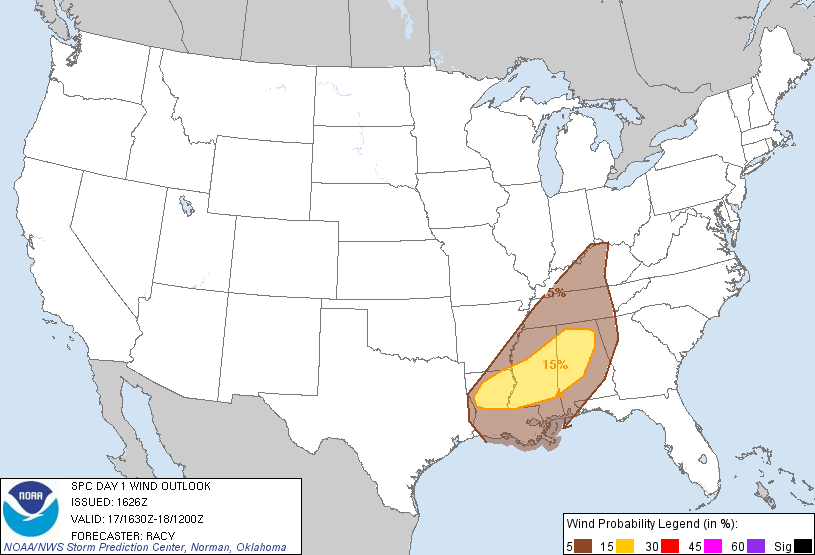
This graphic illustrates primary risk areas for damaging winds:
This graphic illustrates primary risk areas for damaging hail:
***DO NOT USE THIS WEBSITE AS YOUR SOLE SOURCE OF WEATHER INFORMATION, ESPECIALLY WATCHES AND WARNINGS. THIS WEBSITE DELIVERS FOCUSED INFORMATION FOR A SPECIFIC GEOGRAPHIC AREA AND IS NOT INTENDED TO PROVIDE TIMELY WEATHER WARNING INFORMATION***


No comments:
Post a Comment