The Voice of NOAA Weather Radio singing a favorite Christmas tune.
Thursday, December 8, 2011


Tuesday, December 6, 2011
Cold blast tonight & Wednesday
It looks like we'll see a cold blast of air tonight and Wednesday morning, with a slight chance of frozen precipitation across then northern portion of the state. A 50% chance of snow/sleet mix overnight, diminishing to 30% in the morning. Little to no accumulation is expected, but use caution when crossing bridges on the way to work Wednesday morning. (click the picture for animated version)

***DO NOT USE THIS WEBSITE AS YOUR SOLE SOURCE OF WEATHER INFORMATION, ESPECIALLY WATCHES AND WARNINGS. THIS WEBSITE DELIVERS FOCUSED INFORMATION FOR A SPECIFIC GEOGRAPHIC AREA AND IS NOT INTENDED TO PROVIDE TIMELY WEATHER WARNING INFORMATION***

***DO NOT USE THIS WEBSITE AS YOUR SOLE SOURCE OF WEATHER INFORMATION, ESPECIALLY WATCHES AND WARNINGS. THIS WEBSITE DELIVERS FOCUSED INFORMATION FOR A SPECIFIC GEOGRAPHIC AREA AND IS NOT INTENDED TO PROVIDE TIMELY WEATHER WARNING INFORMATION***
Sunday, December 4, 2011
Amateur Radio Blogroll
I've started reading (via RSS) a number of other amateur radio operator blogs. Here's the current blogroll:
KB9MWR - Advancing Ham Radio
KC4BQK - The Future is Digital Communication
N5FDL's EMCOMM Journal - Amateur Radio & Emergency Communications
AI4WM Amateur Radio Blog
KD0BIK Amateur Radio Weblog (also producer of the Practical Amateur Radio Podcast)
KC5FM...focuses on Social Media in Emergency Management
K2DBK's Ham Radio Blog
KB6NU's Ham Radio Blog
K0NR: Radio Enthusiast
The NW7US Beacon
K9ZW With Varying Frequency - Amateur Radio Ponderings
Drop by these fine operators and enjoy their musings about the ether.
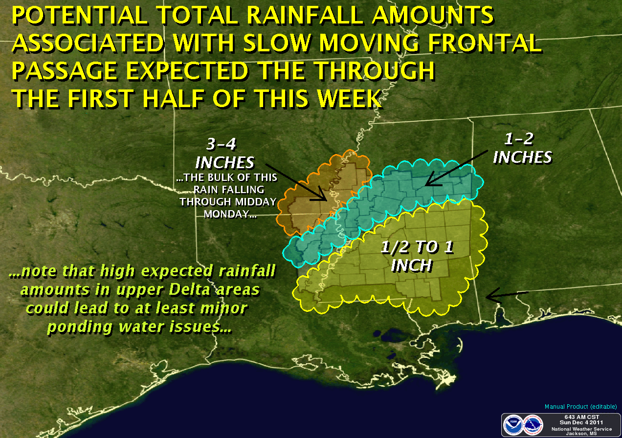
Wet Weather Update
The advancing cold front is moving slower than I originally thought, which means our rains won't start until mid-day today (as opposed to overnight last night). After the front passes, look for temperatures to fall through the week, to the mid-40's for highs, and mid-30's for lows around Wednesday, with continued clouds. Thursday should see a return of sunshine with highs in the 50's, but the clear skies will mean very cold nights toward the weekend.
Be careful for your Monday and Tuesday commute, as locally heavy rainfall can result in ponding of water on the roadway. Give yourself a little extra driving time, and get there safely!

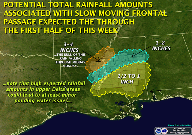
Be careful for your Monday and Tuesday commute, as locally heavy rainfall can result in ponding of water on the roadway. Give yourself a little extra driving time, and get there safely!

***DO NOT USE THIS WEBSITE AS YOUR SOLE SOURCE OF WEATHER INFORMATION, ESPECIALLY WATCHES AND WARNINGS. THIS WEBSITE DELIVERS FOCUSED INFORMATION FOR A SPECIFIC GEOGRAPHIC AREA AND IS NOT INTENDED TO PROVIDE TIMELY WEATHER WARNING INFORMATION***
Saturday, December 3, 2011
Operating Notes - Dec 3, 2011
Enjoyed a good morning on the air for the National Weather Service's SKYWARN Recognition Day. NWS Stations logged today were:
K8DTX - NWS White Lake, Michigan (Detroit)
KC0NWS - NWS Central Region Headquarters, Kansas City, Missouri
N0W - NWS Grand Junction, Colorado (Special Event Callsign)
N7PI - NWS Pocatello, Idaho
W9NWS - NWS Indianapolis, Indiana
WX0GLD - NWS Goodland, Kansas
WX4MLB - NWS Melbourne, Florida
WX4NWS - NWS Louisville, Kentucky
WX4RNK - NWS Blacksburg, Virginia
WX5AMA - NWS Amarillo, Texas
WX5EWX - NWS Austin, Texas
WX5HGX - NWS Houston, Texas
WX5JAN - NWS Jackson, Mississippi
WX8GRR - NWS Grand Rapids, Michigan
WX8WIL - NWS Wilmington, Ohio
WX9ARX - NWS La Crosse, Wisconsin
WX9ILS - NWS Lincoln, Illinois
International Stations logged today:
EA5BZ - Ruben in Elche, Spain, 4873 miles
CX5BW - Pedro in Uruguay, 5208 miles
Friday, December 2, 2011
K5JAW Operating Notes - Dec 2, 2011
Busy week, not much radio time....
Plan to be on the air for the National Weather Service SKYWARN Recognition Day 2011. Amateur Radio enjoys a good relationship with the National Weather Service, and on-air events like this raise the radio community's awareness and interest in our mutually beneficial programs.
QSL cards are in the mail to: HI3/KL7JR, KE8YB, W4DDK, K5ZRK and NA1SS. More will be mailed out next week to international stations.
73, de K5JAW
Wet, Wet Weekend ahead
It looks like the weekend will turn soggy sometime Saturday night, and lasting into Tuesday. Relatively heavy rainfall amounts are expected as a cold front passes through the area. The graphics below show what we might expect.


***DO NOT USE THIS WEBSITE AS YOUR SOLE SOURCE OF WEATHER INFORMATION, ESPECIALLY WATCHES AND WARNINGS. THIS WEBSITE DELIVERS FOCUSED INFORMATION FOR A SPECIFIC GEOGRAPHIC AREA AND IS NOT INTENDED TO PROVIDE TIMELY WEATHER WARNING INFORMATION***


***DO NOT USE THIS WEBSITE AS YOUR SOLE SOURCE OF WEATHER INFORMATION, ESPECIALLY WATCHES AND WARNINGS. THIS WEBSITE DELIVERS FOCUSED INFORMATION FOR A SPECIFIC GEOGRAPHIC AREA AND IS NOT INTENDED TO PROVIDE TIMELY WEATHER WARNING INFORMATION***
Subscribe to:
Posts (Atom)