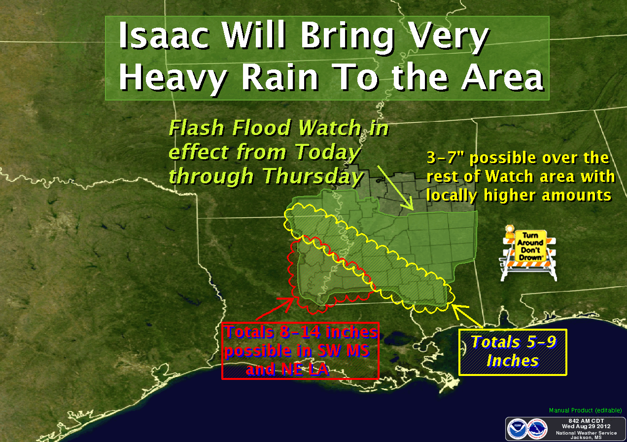
Forecast conditions for the Mississippi Delta have improved with this new forecast track. Wind and rainfall estimates have continued to be revised downward. Wind conditions across the Mississippi Delta through Thursday will consist of sustained 15-25mph winds with gusts of 35-45mph possible in some areas of the Detla. Rainfall estimates now range from 1 to 4 inches, with the highest amounts expected in Washington and Humphreys counties and areas to the south. A Flash Flood Watch is in effect for a large portion of central and south Mississippi, generally along the Highway 16 corridor counties from the Alabama line to Yazoo County, then northwestward to include Washington and Humphreys counties.
The risk for severe weather, including tornadoes, increases through Thursday as Isaac passes to our west.


***DO NOT USE THIS WEBSITE AS YOUR SOLE SOURCE OF WEATHER INFORMATION, ESPECIALLY WATCHES AND WARNINGS. THIS WEBSITE DELIVERS FOCUSED INFORMATION FOR A SPECIFIC GEOGRAPHIC AREA AND IS NOT INTENDED TO PROVIDE TIMELY WEATHER WARNING INFORMATION***
No comments:
Post a Comment